About Mapit Spatial - GIS Collector
This application is our flag product and more sophisticated version of the older apps called MapPad and Mapit GIS with some new ideas implemented and completely redesigned data management approach and is providing...
This application is our flag product and more sophisticated version of the older apps called MapPad and Mapit GIS with some new ideas implemented and completely redesigned data management approach and is providing multi-purpose mapping solution allowing location capture and determines distance and area for the shapes drawn on the map or captured using real-time GPS tracking.
Core functionality:
- collection of spatial data in form of POINT, LINE or POLYGON datasets,
- calculation of areas, perimeters and distances.
- management of the data in form of geopackage projects
- survey design
- data sharing
Application requires access to the file system on the device and from Android 11+ "manage external storage" permission must be accepted to provide the core functionality described above.
The app is designed to be simple and light and driven by new OGC file format for storing spatial data.
Detailed user guide in form of pdf document is available on our website - https://spatial.mapitgis.com/user-guide
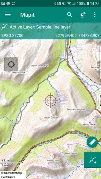
Directly from the app you can access existing multiple Geopackages data sources and their content presented as tiled or feature layers.
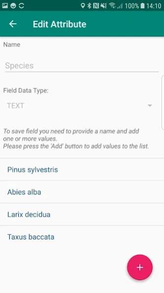
You can also create new Geopackage databases and feature layers and link their fields with the attribute set fields, so the data can be then collected using forms containing drop-down lists, multi-select list, barcode scanner etc. Please see our website for more details.
The application is supporting multiple coordinates projections and you can specify your default coordinate system by providing the EPSG code in the settings - PRJ4 library is used to convert coordinates.
The application is capable to link with high precision GNSS systems - so you can get down to centimetre accuracy if required and take advantage of the RTK solutions provided by the leading GNSS manufacturers.
With Mapit Spatial you can capture, manage and share your data easily. Supported export and import formats: SHP File, GeoJSON, ArcJSON, KML, GPX, CSV and AutoCAD DXF.
Custom WMS, WMTS, WFS, XYZ or ArcGIS Server Tiled services can be added to the software in form of overlays.
Three methods of measurement are supported in form of GPS location, Map cursor location and Distance & Bearing method.
Mapit Spatial can be used in number of applications including:
- environmental surveys,
- woodland surveys,
- forestry planning and woodland management surveys,
- agriculture and soils' types surveys,
- road constructions,
- land surveying,
- solar panels applications,
- roofing and fencing,
- tree surveys,
- GPS and GNSS surveying,
- site surveying and soil samples gathering
- snow removal
The GIS Software and spatial data gathering and processing is getting more and more important these days all over the world and the ability having quick, fast and reliable workflow is becoming very important. Mapit Pro has become a day-to-day tool for thousands of people across the world and we are hoping that Mapit Spatial is going to improve and make your workflow more efficient and cost-effective.
We would like to address our application to everyone who is working with
geographic data and is responsible for location related tasks. There is
number of science and business-related areas relying or depending on the
accurate information coming from Geographic Information Systems and we hope Mapit Spatial is going to become your day-to-day tool when you are
making things right out there in the field.
The app is dedicated to people working in agriculture,
forestry, housing development or land survey industry, but also to customers
responsible for design work in power industry, water supply and sewage
systems. We have successful customers also from gas and oil industry, telecommunication and road engineering.
Mapit Spatial can be also adopted for any kind of spatial asset management tasks, fishery and hunting, habitat and soil mapping or to whatever needs you can think off, but of which the authors of the application have never thought.
Previous Versions
Here you can find the changelog of Mapit Spatial - GIS Collector since it was posted on our website on 2021-12-11 20:37:11.
The latest version is 2.8.1.0C and it was updated on 2024-04-22 12:18:43. See below the changes in each version.
Mapit Spatial - GIS Collector version 2.8.1.0Core
Updated At: 2021-07-12
Changes: ADD: Added information about polygon features area and line features length in feature's list for a layer.
CHANGE: Improved labels for created/updated fields when those are enabled on the layer.
FIX: Fixed issue with the name name of the features in features' list - now selected label field or name is displayed.
FIX: Fixed issue with a date field on some devices.
Disclaimer
Official Google Play Link
We do not host Mapit Spatial - GIS Collector on our servers. We did not scan it for viruses, adware, spyware or other type of malware. This app is hosted by Google and passed their terms and conditions to be listed there. We recommend caution when installing it.
The Google Play link for Mapit Spatial - GIS Collector is provided to you by apps112.com without any warranties, representations or guarantees of any kind, so access it at your own risk.
If you have questions regarding this particular app contact the publisher directly. For questions about the functionalities of apps112.com contact us.